

“Foulbog”
The name of the rural house to my right as I drove over the line separating the Scottish Borders from Dumfries and Galloway which made me giggle. On a par with “Cauldhame”, another building moniker I’ve seen on a walk which would surely make you re-think whether it was the best place to live your life.
The heat of the early morning sun was creating the only mists for miles as frost melted and the blue skies stretched over the southern hills. Only a few weeks earlier I’d stepped over the border between the two local authorities at Ettrick Head in the opposite direction as I walked some of the Southern Upland Way with Mr Clyde. Today I was out with Neil in the same area, even walking some of the same route, but with a different plan.
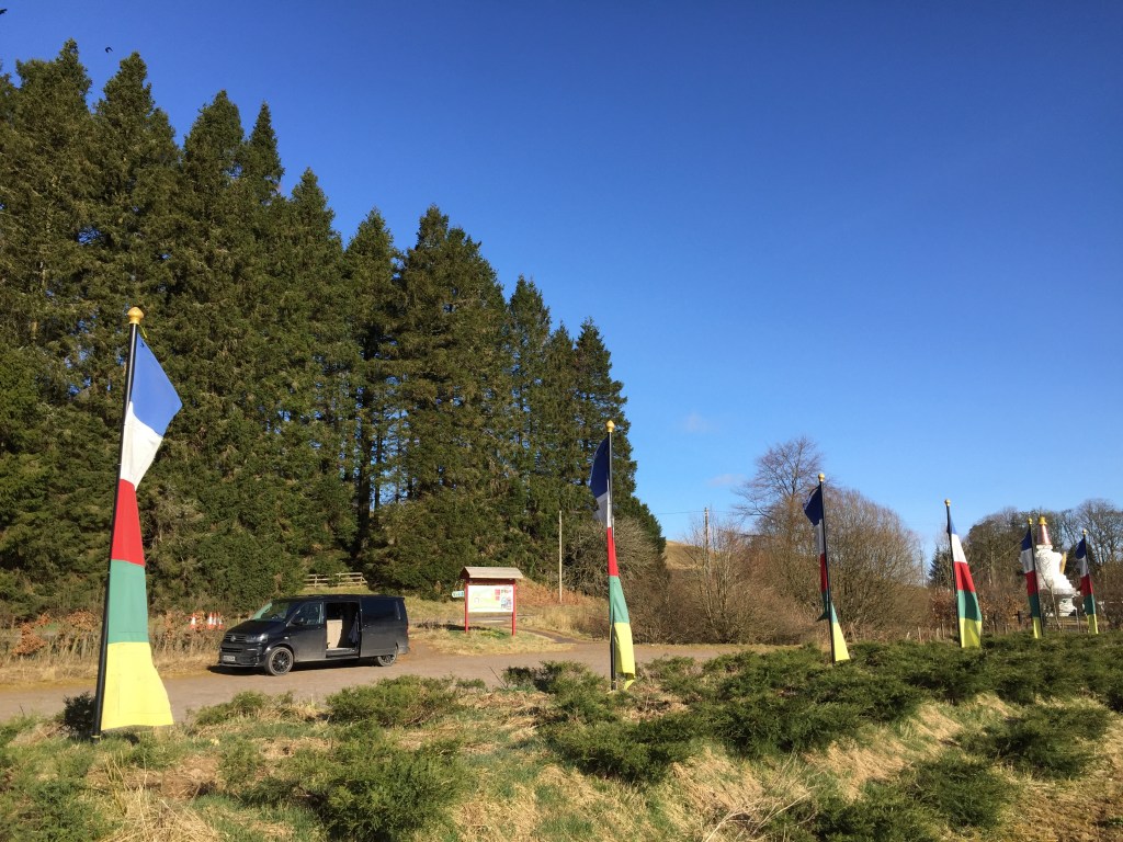
We met at the Samye Ling Tibetan Centre, and after a wander around the grounds of the centre decided what to do with our vehicles and headed to Moffat in Neil’s car.

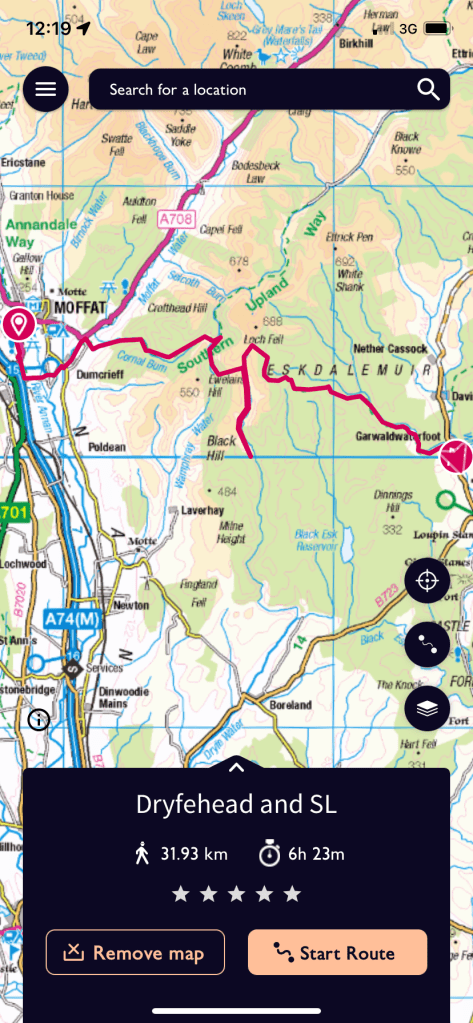
We were walking along the road leaving Moffat almost as quickly as we had driven in, such was our wish to be out in the open countryside. Once again following the Southern Upland Way path I walked with Mr C recently along the river and up the track, it’s always interesting to see a path on different days and in different weathers. There’s also the chance to see something you might have missed first time around. For me it was realisation that I had been calling the main SUW route over Croft Head the “high level route”, when in fact it’s nothing of the sort, it is the main SUW route. Today’s route would continue along the lower level “poor weather route”. Language is important and I kicked myself a little for my sloppiness.

So at Damsel Shoulder, we kept to the forest track and along the poor weather route (also known as the Romans and Reivers Route) and continued walking through the plantations, a wooded feature that would become the norm over the next two days. As well as the abandoned shielings, definitely an under-rated art form as well as practical in their own right.


Neil had mentioned Garrogill in passing as being the toughest part of the day but I don’t think either of us had realised how tough until we saw it. Almost 200m of ascent in less than a km of walking. Even with the plantations the view down the valley was beautiful.


From the top of Garrogil it was a steady drop in ascent down to the bothy, initially on a trail and then later on a forest road.

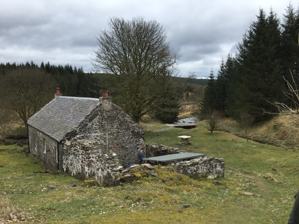
The wood and extra food/water we were carrying were starting to take it’s toll on our backs and shoulders and we were pretty excited to catch site of the Dryfehead bothy roof as we closed in.

The bothy is in a lovely spot, surrounded by the Dryfe Water and Rue Gill (making me wonder why I’d carried as much water with me….) and consists of three rooms, two with fires.

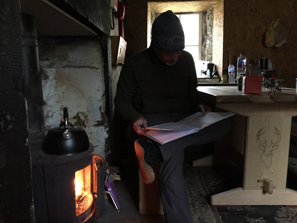
Already inside we met Morten (who we found out was the MO) and Jack (who made the fab new table you can see in the picture below) and they were just finishing a weekends labouring in the right hand room. A cuppa and a whole pack of jammy dodgers restored our energy after the walk in and as Morten and Jack set off, we made up our bed spaces for the evening in the left hand room.
We were joined later by Michael and Morag, and later still by Leah and Keir, who’d walked the same route as us but were heading back the same way to Moffat the next day, while we would be heading towards Eskdalemuir. As darkness fell, Neil became fire chief and the bothy heated up really quickly. We had our tea and as the whisky was removed from our bags the atmosphere became as warm as the the now roaring fire as we all chatted about walking, whisky, primary teaching, Labour Party leaders, Gaelic and a whole lot more besides.
As you’ll see below, I took no pictures of day 2. A combination of weather, recurring plantation views and maybe some icky belly from a little too much Highland Park meant the camera stayed hidden in the depths of my jacket pocket. It’s not like we didn’t reach our final destination in Eskdalemuir, with us vanishing into a bothy black hole, but Dryfehead was a great end to day one, and quite honestly I could have stayed on for a good few days as it is a fab bothy in a lovely location. After breakfast we said goodbye to our new chums and headed for that final destination.
The walk to Eskdalemuir and the Samye Ling Monastery was a breezier affair than the day before and our waterproofs kept us protected from the elements. The number of spruce trees we saw clearly explained the “timber” road we had seen the day before on the way to Moffat. The area is full of forest plantations and the trees and their cheering arms followed us all the way home.
We threw around a lot of Gaelic words around the fire on Sunday night. The best one that I think would describe this trip would be “sgoinneil”, which interestingly includes Neil’s name in it, but also means brilliant or fantastic.
Bha seo coisich sgoinneil! #hopethisiscorrect

Your Thoughts?