

The coronavirus lockdown of the last 10 weeks has finally started to ease a little. On Thursday, 67 long days after it started, Nicola Sturgeon signalled the start of phase one of the lockdown relaxation. I can go to a garden centre (not unheard of, they usually do awesome cakes), play croquet (unlikely but if desperate, you never know) and mingle with one family a day, as long as we remain socially distanced and take our own cutlery. I loved how the First Minister specifically mentioned this at the briefing, as if she had already fully planned her own first barbecue in a post lockdown world. A lovely example of a politician in touch with what her constituents might be asking about.
Hill walking is now back on the agenda, as long as you don’t drive, remain within five miles of home and stay within your own personal limits.
We moved house on November and one of the advantages of daily exercise since March has been the chance to get to know my new local area in a way I probably couldn’t have done in a non-covid age. The lovely Spring weather has been perfect for this. Despite the hardship of the last few months, a rain-sodden spring could have made it even tougher.
As well as exploring my new ‘hood, this year I had made a full year plan of microadventures which didn’t quite get moving. I’m also keen to refresh my navigation skills and I’ve been thinking about a way to tie all this up in a nice, neat package. And so I give you….. grid square journeys. In my head, if it’s done correctly, it would look like this:

The premise is simple. Walk around a grid square on an OS map. Or any other map. A friend of mine on Instagram was looking at maps of The Shire last night. A grid square journey around Hobbiton or Rohan or The Lonely Mountain would be pretty mind blowing.
Anyway, you can choose the square. Those squares are built up from the blue lines that go from left to right and up and down on a map and cross each other regularly creating the grid effect. One square is 1km long in each direction so making a total perimeter of 4km (plus don’t forget to add the distance to get to your chosen square).
The simplicity appeals and this is a much shorter distance than I’d usually go for, but I wanted to see the 360o view of a square, seeing all that it has to offer from every angle. Every rabbit hole, every cave, every pimple hill or mountain.
But the real clincher is navigation, using only a map and compass. No GPS, no phone (other than turning your tracker app on at the start and end to log your route and see how you got on) or any other help. It was a challenge, how close could I get to a perfect square?
There are so many squares to choose from. Some easy, some hard, some so remote you’d need to cover the distance of three OS maps to get too. I started close by (within the 5 mile limit imposed by the Scottish Government) and on a lovely, sunny and warm day. So here goes.
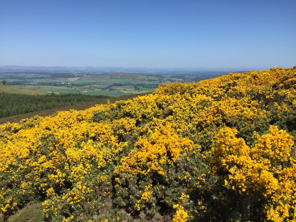
I was going to journey round square NO 1114, which was actually a bit challenging, with hill ground (West Dron Hill), plantation and a loch to consider on my route, the healing waters of Pitkeathly Loch no less. I might have needed those waters as it had been so long since I laced up my boots. But it’s a hill I wanted to explore, and shouldn’t a challenge be fun and pique your interest as well? So up I went, along the back road to the start of the Wallace Road and up over the hill.


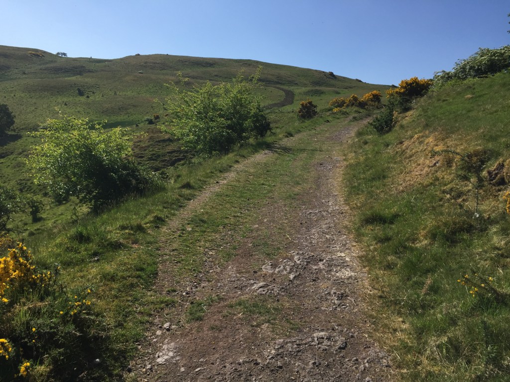

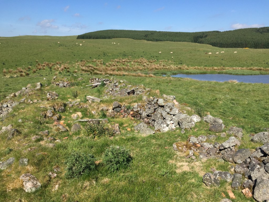
By the time I reached the top, I was feeling the heat but it was a gorgeous day and I decided on a start point for my grid square saunter. I wasn’t going to just start on the grid square, I needed to navigate to it too. So on the map further east of my square you’ll see an old ruin marked West Dron Hill Farm. That would be where I started.

And I set to work. I worked out my direction (pretty easy on a grid square I know…), how long it would take (in distance and duration), any dangers to look out for and how I’d know I’d reached my destination. I’ll include all the info for each stage at the end for those who might be interested.


How did I get on? Let’s see. Here’s my information. The first few lines are what I use for measuring 100m and the rough time I take. Then each block is a section of the walk. Each section has my start and end point. Under that it has my bearing, my distance, the grade of terrain, the number of double steps, the time I estimated and in brackets is the actual time it took.

As I said the only time I touched or looked at my phone was at the very start to turn it on, and at the very end to turn it off. And I was so hopeful to see how I’d done.

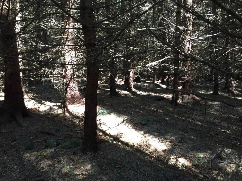
I suppose it could have been worse. The first two sections were pretty ok. The plantation section was awful and the trees and undergrowth made staying a straight line pretty difficult. The gorse hampered my progress on a number of occasions. And it’s triangle!!!!! Not a square! I can’t really explain why that happened. My phone could have lost the signal? There is a wind farm in the area, I walked right under some of the turbines, could that have affected it? Where it stopped is also where I had my lunch, so maybe stopping for a wee while caused an issue with the app.
Whatever happened, it’s a start. I had a fab day in the hills, never far from home, I practised my navigation (and realised I’m in need of lots more practise…..) and I found a new way to explore the hills. And next time, my square will be squarer.
Well. Are you going to give it a try?

Your Thoughts?